Living in Virginia Beach, Virginia: What to Know Before You Move

Quick Snapshot
Virginia Beach sits at the edge of Coastal Virginia, where the Atlantic meets the Chesapeake Bay. On maps and in local talk, you’ll also hear “Hampton Roads” and “Tidewater,” the broader metro that includes Norfolk, Chesapeake, Portsmouth, Suffolk, Hampton and Newport News. As of the latest Census estimates, the city is home to roughly 455,000 people, with a median household income around $90,700 and a mean commute of about 23 minutes. Housing skews toward single-family homes with a long ribbon of oceanfront condos and a pocket of townhome communities near major corridors. Median gross rent sits near the mid-$1,600s; the median value of owner-occupied homes is in the mid-$300Ks. All figures are from the U.S. Census Bureau’s 2019–2023 ACS updates, accessed in 2025.
Small local detail: on sunny weekend mornings, Virginia Beach Boulevard backs up near Lynnhaven as folks fan out toward the Oceanfront. A lot of errands happen along VB Blvd, Princess Anne, and First Colonial, arterials you’ll learn fast.
Neighborhoods & Housing Types
Virginia Beach doesn’t have traditional “wards.” Instead, think in corridors and coastal pockets:
- Oceanfront & North End: High-rise and mid-rise condos, ocean-view townhomes, and older beach cottages tucked on the lanes north of 40th Street. Boardwalk living is three paved miles from 2nd to 40th Street, with a separate bike path and regular events most of the year.
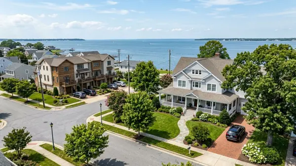
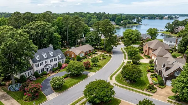
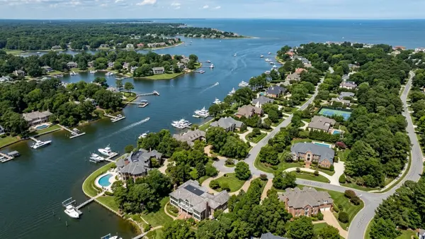
- Great Neck / Shore Drive corridor: Mix of 1960s–1990s single-family homes, clusters of condos, and access to Broad Bay and the Lynnhaven River for those eyeing waterfront lots with docks.
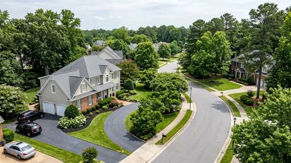
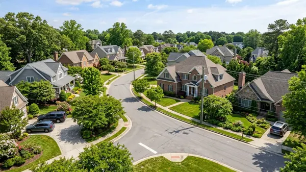
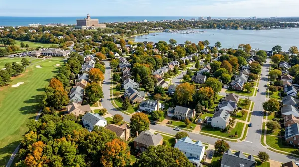
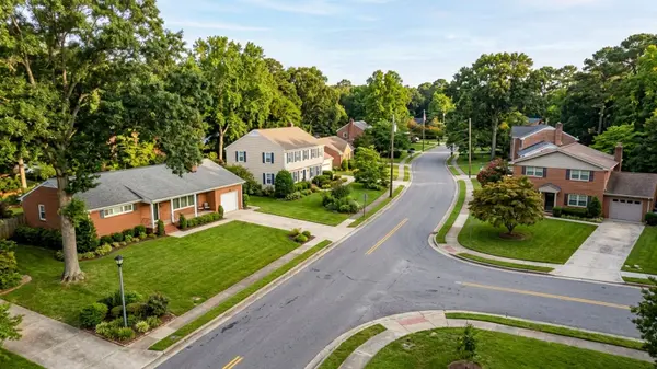
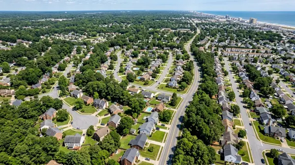
- Kempsville / Aragona / Thalia: Classic suburban subdivisions with garages, cul-de-sacs, and convenient hops to I-264.
- Red Mill / Princess Anne / Salem: Newer subdivisions and planned communities near Sentara Princess Anne and the municipal center.
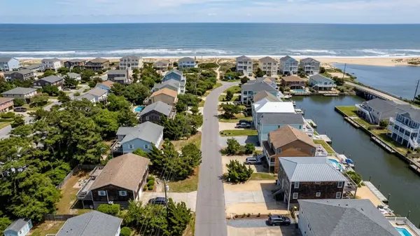
- Sandbridge: Ocean-to-bay barrier-island living where many homes function as second homes or short-term rentals (check zoning and short-term rental rules before purchasing).
- Pungo & the far south: Rural acreage, farm stands, and equestrian properties—the drive is longer, the skies darker, and you’ll pass produce stands on your way home.
- Town Center / Pembroke: Condo towers and stacked-flat options near shopping and restaurants.
Zoning in Virginia Beach is governed by the City Zoning Ordinance, with a separate, form-based code just for the Oceanfront Resort District. If you want to verify what a lot can be used for, or whether an accessory structure is allowed, start there and then check the city’s zoning grid reference map or the Open Data “Zoning District” layer.
Getting Around (Driving, Transit, Bike/Walk)
Driving. I-264 runs east–west to the Oceanfront; I-64 arcs around the metro and ties into the I-264 interchange. The biggest regional chokepoint is the Hampton Roads Bridge-Tunnel (HRBT), where widening and new twin bored tunnels are under construction; VDOT lists the project as the largest highway undertaking in state history, with major 2025 milestones logged and completion milestones continuing through the late 2020s. Plan extra time during peak season.
Transit. Hampton Roads Transit (HRT) runs fixed routes across the city, plus the seasonal VB Wave trolleys along Atlantic Avenue and to the Aquarium/campground (frequent in summer; check current spans). The Metrorail-style “Tide” light rail ends in Norfolk at Newtown Road; from there, buses connect into Virginia Beach. Route listings and VB Wave service details are updated on HRT’s site.
Bike/Walk. The city maintains more than 300 miles of bikeways and shared-use trails, and many parks connect to longer routes like the Cape Henry Trail through First Landing. The Parks & Recreation page and the Open Data portal include current trail inventories. The Boardwalk’s separate bike path is a straightforward north–south spine at the Oceanfront.
Local rhythm: on summer evenings, Atlantic Avenue fills with trolley bells and cruiser bikes; inland neighborhoods use the shared-use paths along Nimmo or General Booth for quick grocery runs.
Jobs & Local Economy
Virginia Beach is part of a regional labor market with roughly 800,000+ nonfarm jobs (2025 levels) spread across defense, tourism, healthcare, retail, logistics, and education. The U.S. Bureau of Labor Statistics publishes monthly area employment updates and sector tables for the Virginia Beach–Norfolk–Newport News (VA–NC) MSA, which is the most reliable way to track trends.
Defense is a core anchor. Naval Air Station (NAS) Oceana, the Navy’s East Coast master jet base, operates around the clock and shapes both employment and flight-path noise footprints east of I-264. If you’re eyeing a home under an AICUZ overlay (Air Installation Compatible Use Zone), review the city’s AICUZ map and disclosures during due diligence.
For a regional view (GDP, industry clusters, and growth priorities) the Commonwealth’s Region 5 Growth & Diversification Plan (covering Hampton Roads) offers recent summaries, including 2023 GDP context and post-pandemic trends led by Virginia Beach, Norfolk, and Newport News.
Schools & Enrollment Basics
Public schools are operated by Virginia Beach City Public Schools (VBCPS). School assignments are address-based:
- Use the VBCPS School Locator to confirm your assigned elementary, middle, and high school. Boundaries are updated periodically; verify just before enrollment or purchase.
- New families should review VBCPS registration requirements, proofs of residency, immunization documentation (Virginia Form MCH-213G or equivalent), and age/identity documents. The division also publishes handbooks and regulation updates each year.
- Attendance zones for 2025–26 are available in the city’s open data portal; note that elementary, middle, and high school zones can differ.
Neutral note on metrics: if you’re comparing test scores or ratios, use official, attributed sources and time frames. Because boundaries change, always confirm with VBCPS before making decisions tied to a specific address.
Parks, Trails & Things to Do
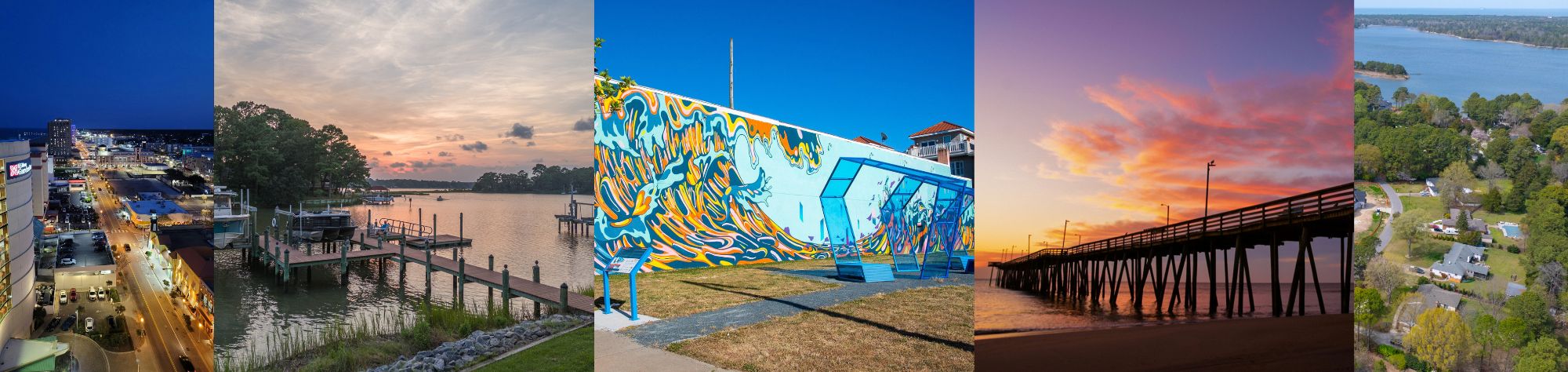
You’ll never run out of outdoor options.
- First Landing State Park (Cape Henry Trail, bay beaches, live oaks).
- Back Bay National Wildlife Refuge and False Cape State Park (wild dunes, migratory birds, and miles of quiet sand south of Sandbridge; access details vary by season).
- Mount Trashmore Park, a 165-acre landfill-to-park conversion with a skate ramp, two lakes, playgrounds, and a skyline hill that draws kite flyers when the northeast wind kicks up.
- The Virginia Beach Boardwalk, three paved oceanfront miles with a parallel bike path from 2nd to 40th Street.
- Virginia Aquarium & Marine Science Center for rainy days and sea turtle releases in season.
For official descriptions, hours, and maps, check Virginia DCR for state parks, U.S. Fish & Wildlife for the refuge, City Parks for Mount Trashmore, and Visit Virginia Beach for Boardwalk specifics.
Local texture: spring means azaleas along Laskin Road, summer evenings bring concerts on the oceanfront stages, and fall’s Neptune Festival caps the season with sand sculptures and crowds along Atlantic Avenue.
Cost of Living & Typical Housing Costs
Housing. From Census 2019–2023 ACS (published 2025): the median value of owner-occupied homes is about $366,300, the median gross rent is about $1,649, and median selected owner costs with a mortgage are roughly $2,070 per month. These provide a baseline; active listing prices and rents vary by neighborhood, view, and condition.
Property taxes & fees. The City Treasurer and Real Estate Assessor publish current tax rates and assessment details. Use the Assessor’s site for valuation methodology and the Treasurer/Tax pages for payment schedules. Many neighborhoods also pay stormwater and utility charges that appear on city bills; review your parcel’s specific charges through the city portals when budgeting.
Rents & affordability context. HUD’s Fair Market Rents (FMRs) for the Norfolk–Virginia Beach area (updated annually) provide a planning benchmark for voucher programs and rent studies; pair those with Census medians when assessing overall affordability. (Consult the current HUD FMR table for the latest 0–4 bedroom figures.)
How to Research Zoning, Permits & Property Records
Step 1: Confirm zoning and overlays.
Start with the Zoning Ordinance (Appendix A) for definitions and use tables, then open the Zoning Grid Reference Map or the Open Data “Zoning District” layer to see a parcel’s district. If you’re near Oceana or Little Creek, also check AICUZ maps. Short-term rentals, accessory structures, and waterfront setbacks are all regulated; read the relevant sections and call Zoning Administration with questions.
Step 2: Look up permits and inspections.
Virginia Beach’s Development Services Center and Permits & Inspections pages outline what needs a permit (from decks to docks), submittal standards, and review timelines. This is where you verify if a finished room over the garage, shed, or pool was permitted.
Step 3: Pull property records and assessments.
Use the VB Property Search (Assessor) for assessed value, land use codes, and sale history; the Treasurer’s real estate tax search for billing; and the Circuit Court Clerk’s land records to retrieve deeds, plats, and liens (onsite or via Secure Remote Access). Keep in mind: the assessor’s record is not a survey. If lot lines matter, order a survey.
Step 4: Check flood data.
For flood zones, consult FEMA’s Flood Map Service Center and the city’s mapping apps. Buyers often review base flood elevations and any prior elevation certificates during the option period.
Public Safety Data: How to Find & Read the Official Dashboards
For an objective look at police-reported incidents:
- VBPD ePRO offers public access to reported crimes and traffic incidents. You can filter by date and basic category and export datasets. Note the limitations: not all reports result in charges, and geocoding may be approximate.
- The FBI Crime Data Explorer aggregates agency-submitted data nationwide; use it to compare time frames and offense definitions at the state or metro level. Pay attention to reporting gaps and methodology notes before drawing conclusions.
Always read dashboards by the same time window (e.g., most recent 12 months) and understand that crime is one factor among many when evaluating a location.
FAQs
What’s “Tidewater” vs. “Hampton Roads,” and where does Virginia Beach fit?
They’re both names for the same metro region. Virginia Beach is the largest city by population and sits on the Atlantic side; the region’s labor stats and transit are usually published at the MSA level by federal and state agencies.
Is there rail service into Virginia Beach?
The Tide Light Rail currently ends at Newtown Road in Norfolk. You can connect from there via HRT bus routes into Virginia Beach; in summer, the VB Wave trolleys circulate along the Oceanfront.
How do I verify which school my address is zoned for?
Use the VBCPS School Locator and confirm directly with the division if you’re close to a boundary or moving mid-year. Attendance zones are periodically updated.
Where can I see typical home values and rents for budgeting?
Census QuickFacts lists the median value of owner-occupied homes and median gross rent (2019–2023 ACS); HUD’s FMRs provide annual rent benchmarks for the region. Always pair these with current market listings for neighborhood-level pricing.
I work in Newport News … what should I know about the commute?
The HRBT corridor (I-64) is being expanded with new twin bored tunnels and widened approaches. It’s a years-long mega-project; check VDOT’s HRBT page for milestones and lane closures before planning peak-hour drives.
How do I check whether a deck, pool, or addition was permitted?
Search the parcel on the city’s permit portals and, if needed, request records from Permits & Inspections. For ownership history and plats, use the Circuit Court Clerk’s land records.
Are there specific fair-housing rules I should know about in Virginia?
In addition to federal protections, Virginia’s Fair Housing Office (DPOR) enforces state law that covers additional protected classes such as source of income. Review the state’s summary and complaint process for details.
Sources
- U.S. Census Bureau — QuickFacts: Virginia Beach city, Virginia (population, income, housing, commute).
- City of Virginia Beach — Code of Ordinances (Appendix A: Zoning); Zoning & Map Center; Open Data Portal.
- City of Virginia Beach — Real Estate Assessor & Treasurer Real Estate Tax.
- Virginia Beach Circuit Court Clerk — Real Estate Records (Deeds) & Secure Remote Access.
- FEMA — Flood Map Service Center (flood zones).
- VDOT — Hampton Roads Bridge–Tunnel Expansion.
- Hampton Roads Transit — Routes & VB Wave.
- Virginia Beach Parks & Recreation — Bikeways & Trails and Mount Trashmore Park.
- Visit Virginia Beach — Virginia Beach Boardwalk.
- Virginia DCR — First Landing & False Cape State Parks.
- U.S. Fish & Wildlife Service — Back Bay National Wildlife Refuge.
- VBCPS — School Locator, Registration Requirements, Attendance Zone layers (2025–26).
- VBPD — ePRO Police Reports Online; FBI — Crime Data Explorer.
- HUD — Fair Market Rents (Norfolk–Virginia Beach HMFA).
- Virginia DPOR — Fair Housing Office (state protections & process).
Categories
Recent Posts